Skip to content
  • Map
  • Route Finder
  • Route Planner
  • Travel Guide
  • Community
Sign up or log in
  • Map
  • Route Finder
  • Route Planner
  • Travel Guide
  • Community
Sign up
  • Places & Accommodation
    • Places to visit
    • Eat & drink
    • Huts
    • Accommodation
    • Ski resorts
    • Crags
  • News & Conditions
    • Current Conditions
    • Weather
    • Webcams
    • Avalanche Report
    • Events
  • Inspiration
    • Collections
    • Offers
    • Travel Stories
    • Publications
  • Community
    • Challenges
    • Groups
  • Settings
  • Help
Travel Guide Aruba
more
  • Oranjestad, Aruba
    Oranjestad, Aruba Photo: CC0, pixabay.com
  • Coral coast in Aruba
    Coral coast in Aruba Photo: CC0, pixabay.com
  • Beach in Aruba
    Beach in Aruba Photo: CC0, pixabay.com

Aruba

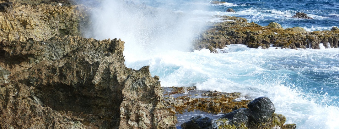
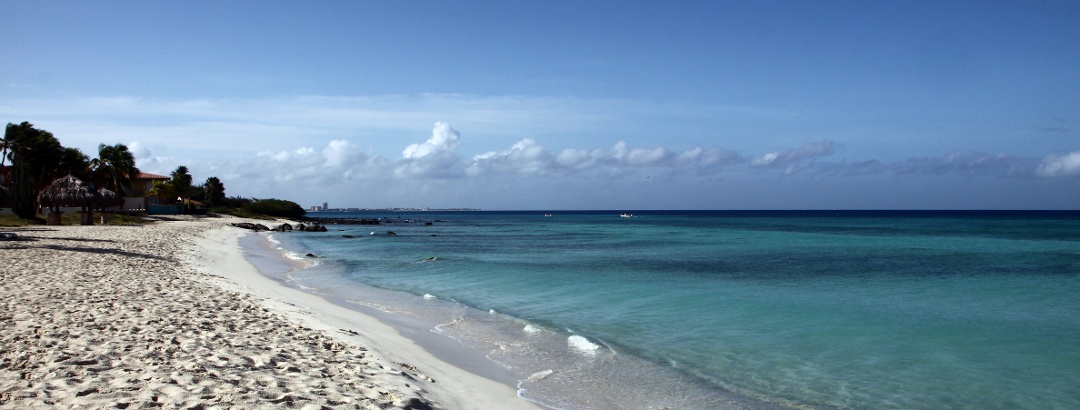
Aruba is a small island north of Venezuela and part of the Lesser Antilles. Special attractions for travelers are the Caribbean beaches and the protected underwater world around the island, which is extremely popular with divers. About one fifth of the island belongs to the Arikok National Park. Besides rare animal and plant species such as the Divi Divi trees tilted by the wind, the Fontein Cave is the main attraction of the park. A nice afternoon walk will take you through the colorful capital Oranjestad, where you will find traces of the Dutch colonial period as well as US-American influences.
Find out more
Outdooractive Editors  Verified partner 
Author of this page

Activities in Aruba


Crags

Attractions in Aruba


Highlights

  • My Map
  • Content
  • Show images Hide images
Features
2D 3D
Maps and trails
Discover
Inline Skating · Aruba
Aruba - Linear park
Difficulty
Distance 4.6 km
Duration 0:27 h
Ascent 12 m
Descent 15 m

Route from 'Oranjestad, Oranjestad' to 'L.G. Smith Boulevard, Oranjestad' via 'Oranjestad, Oranjestad'

from Luis & Gina Mansur,   Community
Hiking route · Aruba
Jamanota from Rooi Taki - 6km
Map / Jamanota from Rooi Taki - 6km
Difficulty moderate
Distance 5.9 km
Duration 2:37 h
Ascent 235 m
Descent 235 m

Route to Jamanota from Rooi Taki.

from Thomas Nuijten,   Community
Discover more
  • My Map
  • Content
  • Show images Hide images
Features
2D 3D
Maps and trails
Discover

Trip planning


Getting there

Destinations in Aruba


Localization

Parts of this content were machine translated using German as the source language

THE way to start your next outdoor experience!
Sign up now
App Store
Google Play Store
Huawei App Gallery
  • Our services
    • Features
    • Pro and Pro+
    • Pro for Search & Rescue
    • Enjoy benefits and discounts from our partners
    • Vouchers
    • B2B
  • More services
    • Help Center
    • Blog (German only)
    • Shop
    • Newsletter
    • Affiliate Program
    • Contact Us
  • Corporate
    • Discover Outdooractive
    • Outdooractive30
    • Careers
    • Outdooractive Business
Learn more about the apps for Android and iOS
1% for the Planet Digitize the Planet
Choose a language
English
  • Deutsch
  • italiano
  • français
  • español
  • עברית
  • 中文
  • română
  • português (Portugal)
  • português (Brasil)
  • čeština
  • suomi
  • русский
  • magyar
  • norsk bokmål
  • slovenčina
  • Nederlands
  • 日本語
  • українська
  • हिन्दी
  • Türkçe
  • Ελληνικά
  • Mobile version
  • Terms and conditions
  • Privacy policy
  • Cancellation policy
  • Customer information
  • Terms of payment
  • Map information
  • Legal Disclosure